
WHAT'S HIDING BEHIND THIS WATERING HOLE?

A SPANISH ROAD MARKER
We pass this everytime we go from Hågat to Hagåtña or vice versa, but it is hidden from Route 1 by the bar/eatery. It lies just before we make the left turn from Route 1 towards Hågat, just before the main gate at Naval Station.
This area is called Atantåno', and at one time it was farming territory. Because of its swampy terrain, it was used for rice cultivation.
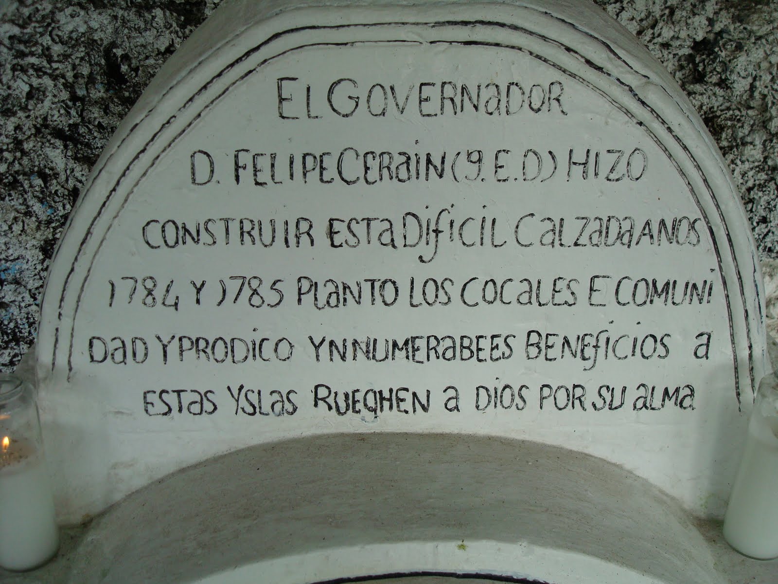
The upper part of the marker commemorates the work of
former Governor Don Felipe Cerain who had the road built and
planted the coconut groves in the years 1784 and 1785.

The bottom portion relates how former Governor Don Francisco Villalobos
established the first rice plantation in this location from 1832-1834
with the participation of the Gobernadorcillos (who were Chamorro
and whose position was akin to a mayor)
Don Antonio Guerrero, Don Juan de Rivera and Don Lucas de Castro,
and the Cabezas de Barangay (neighborhood leaders).
They named the plantation
"La Cienega de la Purisima,"
The Marsh of the Immaculate (Virgin Mary).

The base of the entire marker is from the American period. It tells us that the road was rebuilt in 1908-1909 under Governor Dorn and by Eugene L. Bisset. Bisset was a naval officer who also bought a lot of land in the north of Guam. His daughter later married one of the Arteros.
No comments:
Post a Comment