A village picked itself up and moved down the road.
What we call Agat today was not the original location of that village, called Hågat in Chamorro.
Why the change? World War II
THE ORIGINAL LOCATION

In this pre-war map, you can see that Agat was located north of the present location of the village. A good landmark to orientate yourself is Ga'an Point, where there are Japanese guns located to this day. Ga'an Point is where the present village of Agat is located. In the higher circle, you can see the original village of Agat, with its several streets. The area which later became New Agat was once farmland.

Here is another map, based on pre-war information, showing the original location of the village. South of the old village, there is nothing but farmland and jungle.
THE U.S. INVASION

This map shows the invasion point for the U.S. forces in Agat. The village is clearly in the way of the incoming American troops. The village church and its homes were all destroyed or damaged by American pre-invasion bombing.

Another view of the American invasion. The original village is just to the left of this map outlining the invasion. The new village lies in the center of this map, at Ga'an Point.
"NEW" AGAT
But in Agat's case, the Americans called the new location of the village "New Agat." The name "New Agat" persisted even into the 1960s.
The area where the current village is located covers places with different names. By the shoreline is Ga'an, which is also the name of the point. As the terrain then rises gently up to Mount Alifan, the inner part of present-day Agat was called Alifan. In the first map posted above, you can see the names of the other sites in the area.

In this map right after the war, you can see the village is now called "New Agat" and it is located down the road from the original location.

"New Agat" right after the war, with temporary housing structures built for the people.

A government record of planned sewage lines after the war talks about connecting the lines to "New Agat."

Even into the 1960s, as seen in this 1963 economic report, the government talked about "New Agat." The name "New Agat" disappeared from ordinary conversation by the 1970s. "New Agat" just became "Agat" or "Hågat."
SO WHAT REMAINS OF "OLD" AGAT?

 |
| Photo by Frankie Casil |
The 76 Gas Station is approximately where the pre-war church used to stand.

The old Agat Cemetery, which can be missed by passersby, is the southern border of the old village.

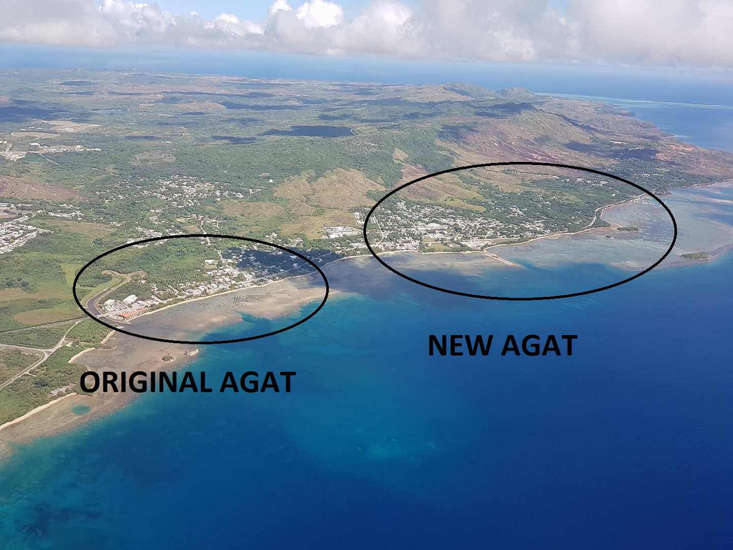
Looking at a modern map, showing the relation between the old village and the new
No comments:
Post a Comment